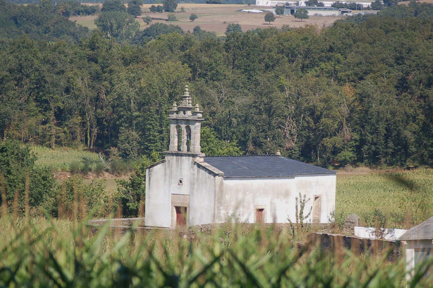
San Mamede do Camino
San Mamede do Camino is a small locality in the province of Lugo, Galicia. Historically, it has been a significant resting point for pilgrims traveling on the Camino de Santiago. The name of the locality is derived from the Church of San Mamede, which is dedicated to Saint Mammes, a Christian martyr from the 3rd century. The church, built in the 12th century, has a Romanesque architectural style and features a beautiful semicircular apse. The area surrounding San Mamede do Camino has been inhabited since pre-Roman times, and there are several archaeological sites nearby, such as the Castro de San Lourenzo, a fortified Iron Age settlement. The presence of these ancient sites highlights the long history of the region and its importance as a crossroads for various cultures and peoples throughout the centuries. Today, San Mamede do Camino continues to welcome pilgrims on their journey, offering them a place to rest and reflect on their spiritual journey.
Plan this stage in the app
Turn this route data into a practical day plan with live maps, elevation profiles, and stay planning.
- Track your live location on the route map.
- Check distance and elevation before you start.
- Save your preferred stays and book when ready.

Next on the route
Sarria
Sarria is a significant historical locality on the Camino de Santiago. Located in the province of Lugo, Galicia, it has been an...
ATMBar / RestaurantFood ShopMedical ClinicPharmacyPost Office
Open Locality Guide Accommodation in San Mamede do Camino
Compare albergues, hostels, pensions, and hotels in this locality, then book or continue planning in the app.